The Enaire Drones map is the primary tool—the most comprehensive and legally valid one—for flying any type of drone in Spain, whether in the open category or in the specific STS-01 and STS-02 categories.
It details all the areas and zones that require a permit or prior notification to fly a UAS in Spanish territory.
The Enaire Drones map, the zones and rules of drone flight, especially after the last change in the regulations that was made through Royal Decree 517/2024, are in continuous change and evolution, having, in my opinion, taken a more restrictive but at the same time more professional turn.
One example of a positive change in this latest update has been to decrease the radius of action of the dreaded ‘CTR zones’ (the main battle horse of drone pilots), as these zones require more intricate logistics when applying for a permit to fly.
Areas of the Enaire Drones map with flight restrictions
Below I will list all the possible restrictions you will find when consulting the Enaire Drones map, I will help you to interpret each one of them and I will detail the information you will need in order to apply for the flight permit.
It is very important for you to know that there are national regulations, i.e. that they affect all parts of Spain, as well as regional regulations.
As I live in Mallorca, I provide you with all the information about the Balearic Islands as I have them very close at hand and I know a lot more about what you need to know to fly drones in Mallorca.
The ENAIRE Drones map is an indispensable tool for finding out the restrictions applicable to drone flights in Spain.
If you have any problems with requesting drone flight permits, I remind you that I have a drone flight permit consultancy, management and processing service. Please contact me for more information.
Below, I list and explain the most common restrictions you will find on the Enaire Drones map, along with the solutions and contacts needed to manage these restrictions:
Controlled Airspace (CTR,FIZ and ATZ) on the Enaire Drones map

- Description: Areas near airports where drone flight is restricted due to manned air traffic management. These areas ensure the safety of manned and unmanned aircraft.
In the yellow zones you can fly freely up to a certain altitude depending on whether it is an airport, airfield or heliport.
To fly in the red zone you have to fulfil a number of requirements (more info below) - What you can do:
- In NON-free flight zones you must request a permit from ENAIRE at least 21 days in advance.
- Flying without a specific permit is strictly prohibited in areas where permits are required. Heavy fines.
- Contact: Through info@enaire.es or telephone 91 321 20 00.
More information on what I have told you about in controlled airspace areas (ap 2.2 and 2.3).
Protected Natural Spaces | ENP
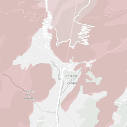
- Description: Areas designated to protect biodiversity, such as national parks or wetlands. Flying drones can disrupt the ecological balance.
- What you can do:
- Check with the managers of the natural area for possible exceptions. Check here for information on flights in ENP in the Balearic Islands.
- Avoid flying without specific permission in these areas.
- Fill in the official form to request permission to fly your drone in ENP and send it electronically.
- Contact: If you are NOT a RESIDENT in Spain or do not have a Spanish ID card, you will NOT be able to send it telematically, so you will have to hand it in at the offices of the corresponding park or protected natural area (in the Balearic Islands).
Special Bird Protection Areas (ZEPA)
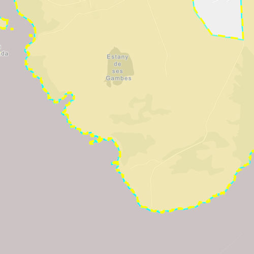
- Description: Areas designated to protect biodiversity, such as national parks or wetlands. Flying drones can disrupt the ecological balance so recreational flying in this area is PROHIBITED, so you will only be able to fly your drone for professional tasks (i.e. for a fee).
- What you can do:
- Avoid flying without specific permission in these areas.
- Consult the ZEPA Area in the whole of Spain
- Fill in the official form to request permission to fly your drone in SPA areas.
- Contact: If you are NOT a RESIDENT in Spain or if you do not have a Spanish DNI you will NOT be able to send it electronically, you must send it by email to especies@dgmedinatural.caib.es
Photographic flight restricted areas | ZRVF

- Description: A restricted drone photography zone is an area where regulations limit or prohibit the capture of aerial images due to safety, privacy, environmental protection, or specific legal restrictions. Requests that are not made at least 15 business days prior to the requested flight date will not be considered, and we reserve the right (in some cases) not to respond.
- Military bases and embassies.
- National parks and protected areas.
- National security events or drone air shows.
- What you can do:
- Fill in the document correctly and return it by email to the Centre for Cartographic Studies.
- Contact: cecaf@ea.mde.es
Population centres, recreational and residential areas
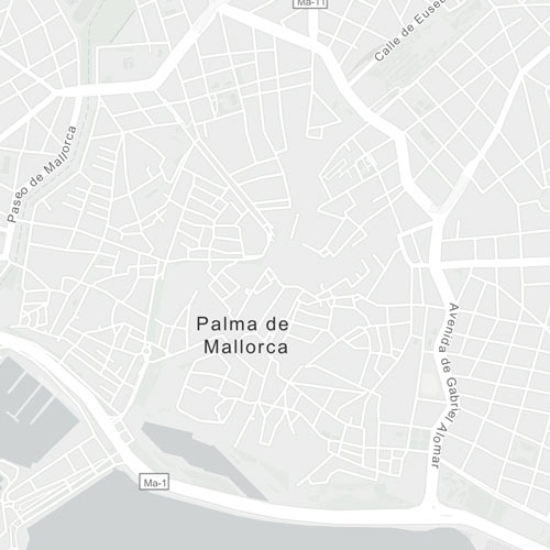
- Description: Flying in cities or residential areas is quite regulated to protect the safety of people and property (especially after the latest change in RD 517/294). To fly in these areas it is mandatory to notify the Ministry of Interior at least 5 days in advance.
- What you can do:
- Notify the Ministry of the Interior in advance.
Learn how to use the Chrome extension, Flyform, to make it easier to fill in the details when communicating. - In urban areas apply, in addition to the notification to the Ministry of Interior, for special authorisations for filming or specific works if necessary.
- Use drones with advanced security systems and notify local authorities.
- Notify the Ministry of the Interior in advance.
- Contact: Fill out the form and submit it online. Individuals who are NOT RESIDENTS of Spain or do not have a Spanish ID number (DNI) may NOT submit the form online; they must fill it out by hand and submit it in person at any registration office of the General State Administration. To apply for drone flight permits, fill out the following form to verify the feasibility of your project.
NOTAM (Notice to Airmen): Zonas temporales de restricción

- Description: Temporary restrictions established for events, air shows or emergencies that temporarily affect airspace. In many cases, notification to the Ministry of Interior is also required. En mi artículo sobre cómo interpretar un NOTAM para drones en España te lo cuento todo.
- What you can do:
- Check the updated NOTAMs before each flight.
- Adjust your flight plan to try to avoid these areas.
- Check the date and flight of the NOTAM carefully as it may be that during the day it is only active for certain hours, the rest of the time you may be able to fly.
- Contact: ENAIRE website for NOTAM and SNPDRON portal (sede.mir.gob.es) and consult the Enaire Drones map information box.
Compliance and Security
Always consult the ENAIRE Drones map before planning a flight. Respect these restrictions and make the corresponding notifications to the Ministry of the Interior to avoid penalties and ensure the safety of airspace and people on the ground.
If something is not clear to you in this article do not hesitate to ask me, and if you want to make any contribution to help us improve it is always welcome, just write it in the comments.
Frequently Asked Questions About the ENAIRE Drones Map
What is the ENAIRE Drones map?
The ENAIRE Drones map is an official tool for checking airspace information before flying a drone in Spain. It allows users to review UAS-designated areas, restrictions, advisories, and potential limitations that may affect drone operations.
What is the ENAIRE Drones map used for?
It helps you plan drone flights more safely and check whether an area has restrictions, prohibitions, warnings, nearby airports, controlled zones, protected natural areas, or other conditions that could affect the flight.
How do you use the ENAIRE map for drones?
To use the ENAIRE Drones map, open the app, enter the basic flight details, select the maximum planned altitude, indicate whether you will be conducting a photographic flight, and search for the location where you want to operate. Then review the layers and advisories that appear on the map.
How do I know if I can fly my drone in an ENAIRE zone?
You should locate the area on the map, select the type of flight, and review the notices that appear when you select the location. If ENAIRE Drones indicates any restrictions, limitations, or the need for coordination, you should not fly until you have verified what requirements or permits are needed.
What do the colors on the ENAIRE Drones map mean?
The colors on the map help identify areas with different flight conditions. Some areas may have restrictions, others may require prior authorization, and still others may be off-limits. It’s important not to just look at the color, but to always read the notice or message associated with the area.
Can I fly a drone near an airport if I check with ENAIRE?
The map allows you to check whether an area near airports, airfields, or heliports is subject to restrictions. If controlled airspace, an ATZ, FIZ, CTR, or other restriction appears, you will need to review the applicable requirements and request authorization or coordination as appropriate.
What should I do if the ENAIRE map indicates that I need permission?
If ENAIRE Drones indicates that you need a permit, authorization, or coordination, you must not conduct the flight until these requirements have been properly addressed. Flying without complying with the conditions of a restricted area may result in penalties and aviation safety issues.
Does the ENAIRE Drones map show NOTAMs?
Yes, ENAIRE Drones can display advisories and NOTAMs relevant to drone operations. Since this information is subject to change, it is advisable to check the map shortly before the flight and not rely solely on a search conducted days earlier.
Do I need to check with ENAIRE Drones before every flight?
Yes. It is advisable to check ENAIRE Drones before every flight, even if you have flown in that same area before. Restrictions, advisories, NOTAMs, or airspace conditions may change and affect a specific flight.
Is consulting the ENAIRE Drones map enough to fly legally?
No siempre. El mapa de ENAIRE Drones es una herramienta clave para revisar restricciones y zonas geográficas UAS, pero el piloto u operador también debe cumplir la normativa aplicable, los requisitos de formación, el registro como operador cuando corresponda y cualquier permiso específico según la zona de vuelo.